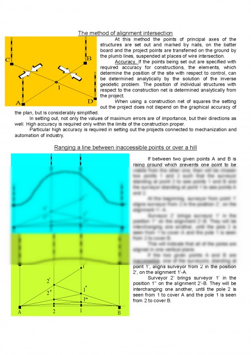
At this method the points of principal axes of the structures are set out and marked by nails, on the batter board and the project points are transferred on the ground by the plumb lines, suspended at places of wire intersection.
Accuracy. If the points being set out are specified with required accuracy for constructions, the elements, which determine the position of the site with respect to control, can be determined analytically by the solution of the inverse geodetic problem. The position of individual structures with respect to the construction net is determined analytically from the project.
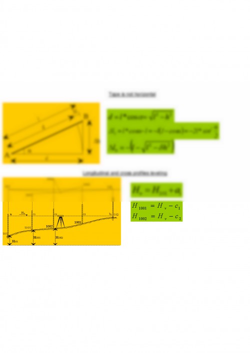
When using a construction net of squares the setting out the project does not depend on the graphical accuracy of the plan, but is considerably simplified.
In setting out, not only the values of maximum errors are of importance, but their directions as well. High accuracy is required only within the limits of the construction proper.
Particular high accuracy is required in setting out the projects connected to mechanization and automation of industry.
Ranging a line between inaccessible points or over a hill
If between two given points A and B is rising ground which prevents one point to be visible from the other one, then will be chosen two points 1 and 2 such that the surveyor standing at point 2 to see points 1 and B and the surveyor standing at point 1 to see points A and 2.
At the beginning, surveyor from point 1' aligns surveyor from 2 in the position 2', on the alignment 1'- A .
Surveyor 2' brings surveyor 1' in the position 1'' on the alignment 2'-B. They will be interchanging one another, until the pole 2 is seen from 1 to cover A and the pole 1 is seen from 2 to cover B.
This will indicate that all of the poles are aligned in one vertical plane.
If the two given points A and B are inaccessible, one of the surveyors, standing at point 1', aligns surveyor from 2 in the position 2', on the alignment 1'-A.
Surveyor 2' brings surveyor 1' in the position 1'' on the alignment 2'-B. They will be interchanging one another, until the pole 2 is seen from 1 to cover A and the pole 1 is seen from 2 to cover B.
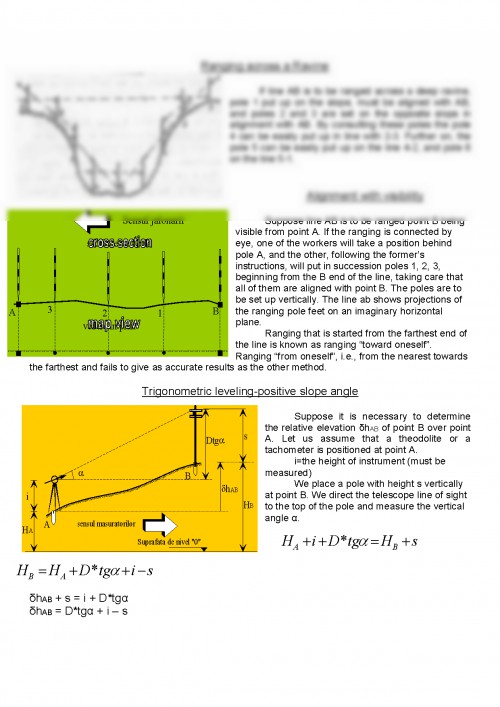
Ranging across a Ravine
If line AB is to be ranged across a deep ravine, pole 1 put up on the slope, must be aligned with AB, and poles 2 and 3 are set on the opposite slops in alignment with AB. By consulting these poles the pole 4 can be easily put up in line with 2-3. Further on, the pole 5 can be easily put up on the line 4-2, and pole 6 on the line 5-1.
Alignment with visibility
Suppose line AB is to be ranged point B being visible from point A. If the ranging is connected by eye, one of the workers will take a position behind pole A, and the other, following the former's instructions, will put in succession poles 1, 2, 3, beginning from the B end of the line, taking care that all of them are aligned with point B. The poles are to be set up vertically. The line ab shows projections of the ranging pole feet on an imaginary horizontal plane.
Ranging that is started from the farthest end of the line is known as ranging "toward oneself". Ranging "from oneself", i.e., from the nearest towards the farthest and fails to give as accurate results as the other method.
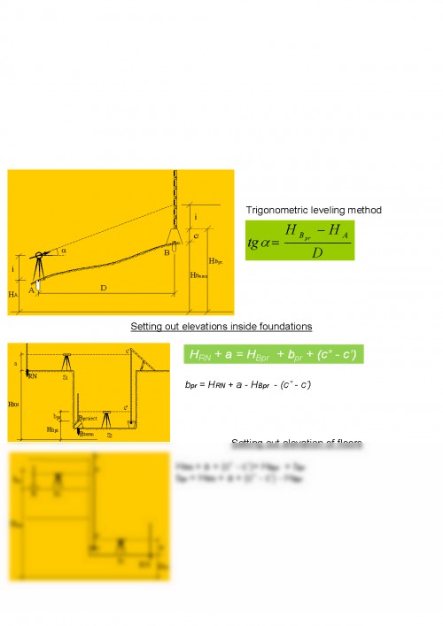
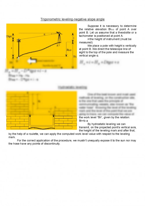
Trigonometric leveling-positive slope angle
Suppose it is necessary to determine the relative elevation ?hAB of point B over point A. Let us assume that a theodolite or a tachometer is positioned at point A.
i=the height of instrument (must be measured)
We place a pole with height s vertically at point B. We direct the telescope line of sight to the top of the pole and measure the vertical angle ?.
Documentul este oferit gratuit,
trebuie doar să te autentifici in contul tău.